
Leesburg, Ohio
Thermal Drone Deer Recovery and Pet Rescue
Thermal Deer Recovery | Pet Rescue | Herd Analysis | Custom Property Maps in Ohio
Game-Changing Tools for Serious Hunters
Elite Deer Recovery utilizes drones to provide game-changing tools for serious hunters and landowners across Southern Ohio. Using thermal drone technology, we help recover deer when the trail runs cold, deliver in-depth herd analysis to track population health, and create high-resolution aerial maps so you can visualize and understand your property like never before. Whether you’re managing your land for better hunting or need help finding your trophy, we’ve got you covered from above.
Fast. Reliable. Drone Deer Recovery
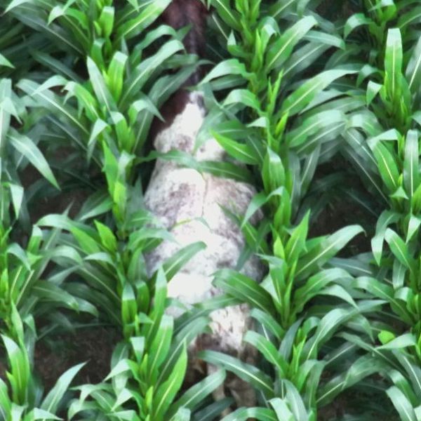
Elite Deer Recovery, we specialize in using Thermal Drones throughout Ohio for drone deer recovery. Our thermal imaging technology allows us to cover large areas quickly, day or night, and even in thick cover or difficult terrain.
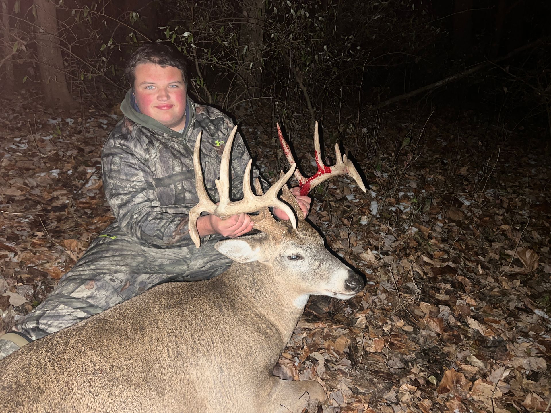
With two full seasons under our belt and over 225 successful recoveries, Elite Deer Recovery has the experience hunters trust when it matters most. Our team knows how to handle tough terrain, challenging conditions, and high-pressure situations to get your deer found fast. When you call us, you’re getting proven results backed by expertise in thermal drone technology and a track record of success.
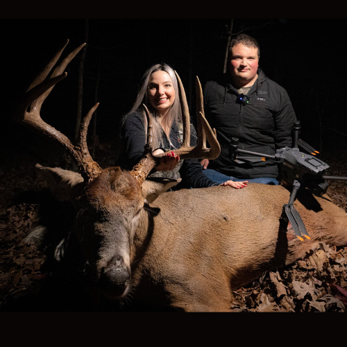
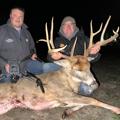
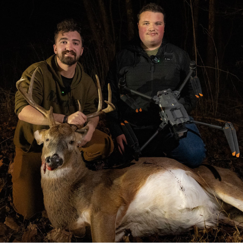
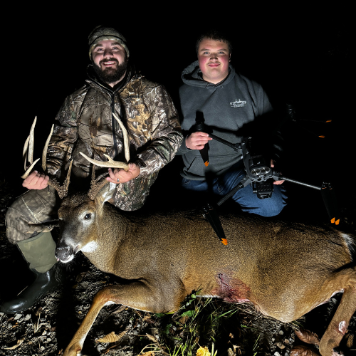
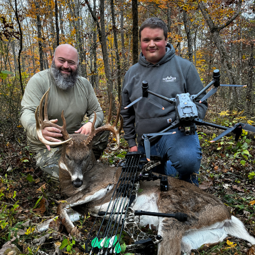
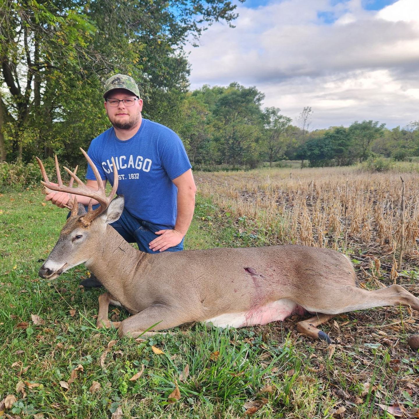
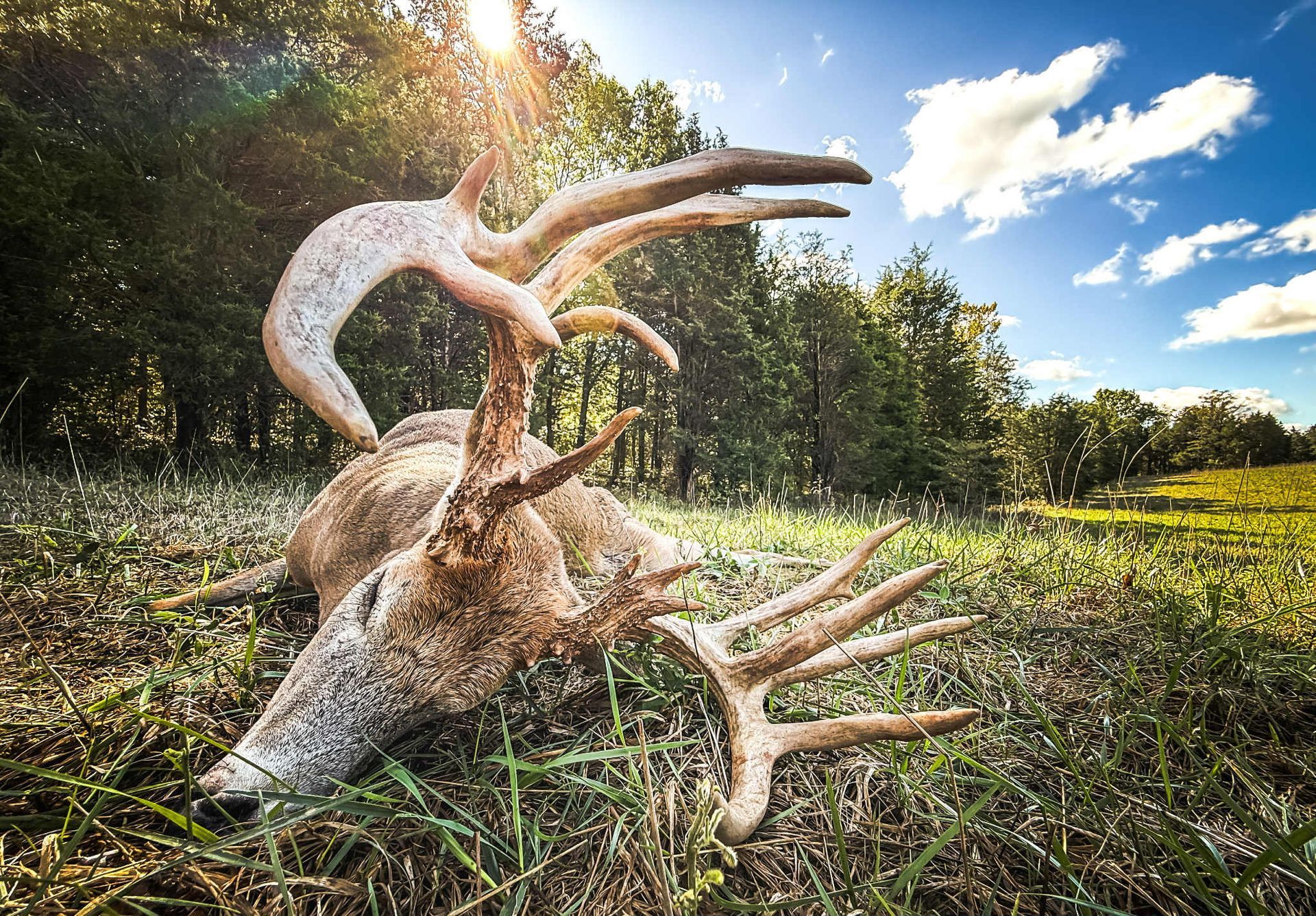
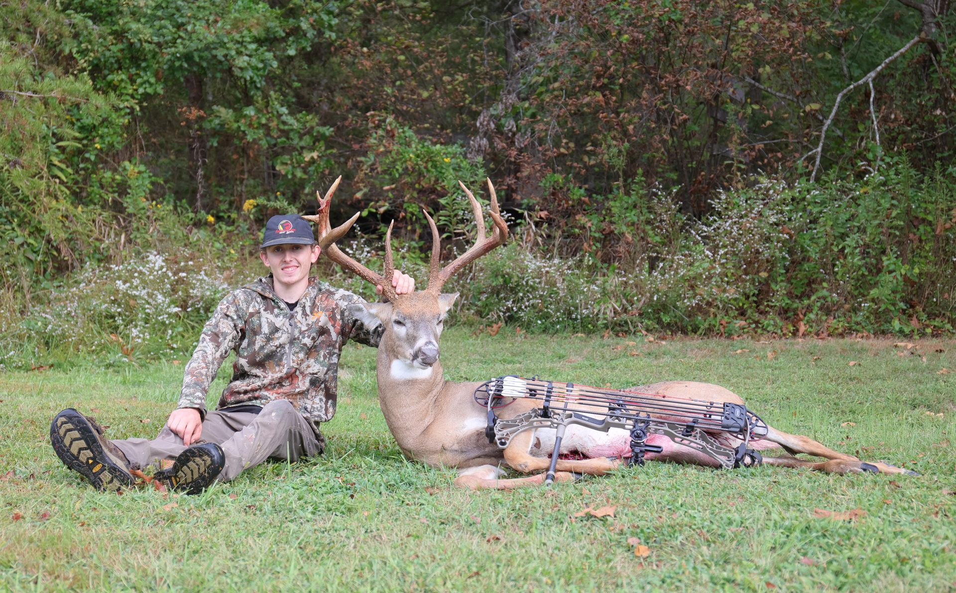
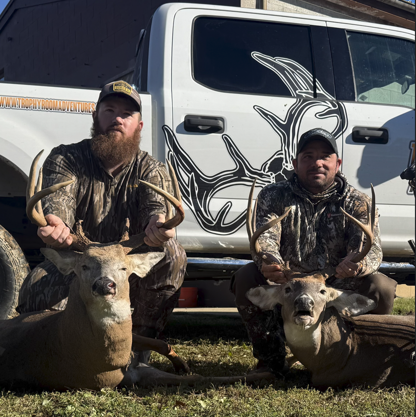
Our Recent Recoveries
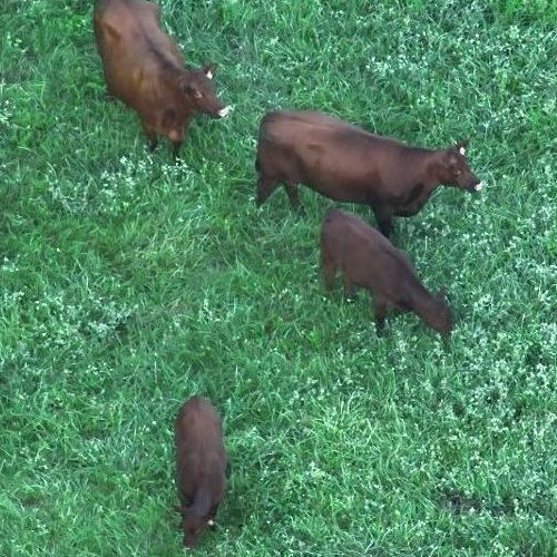
Submission Grade Wildlife surveys
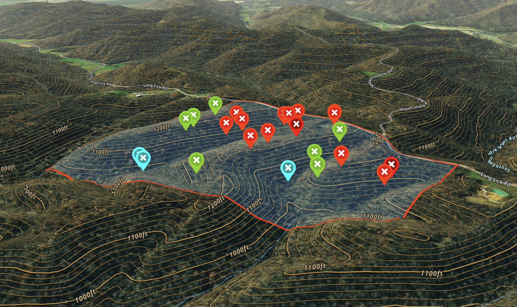
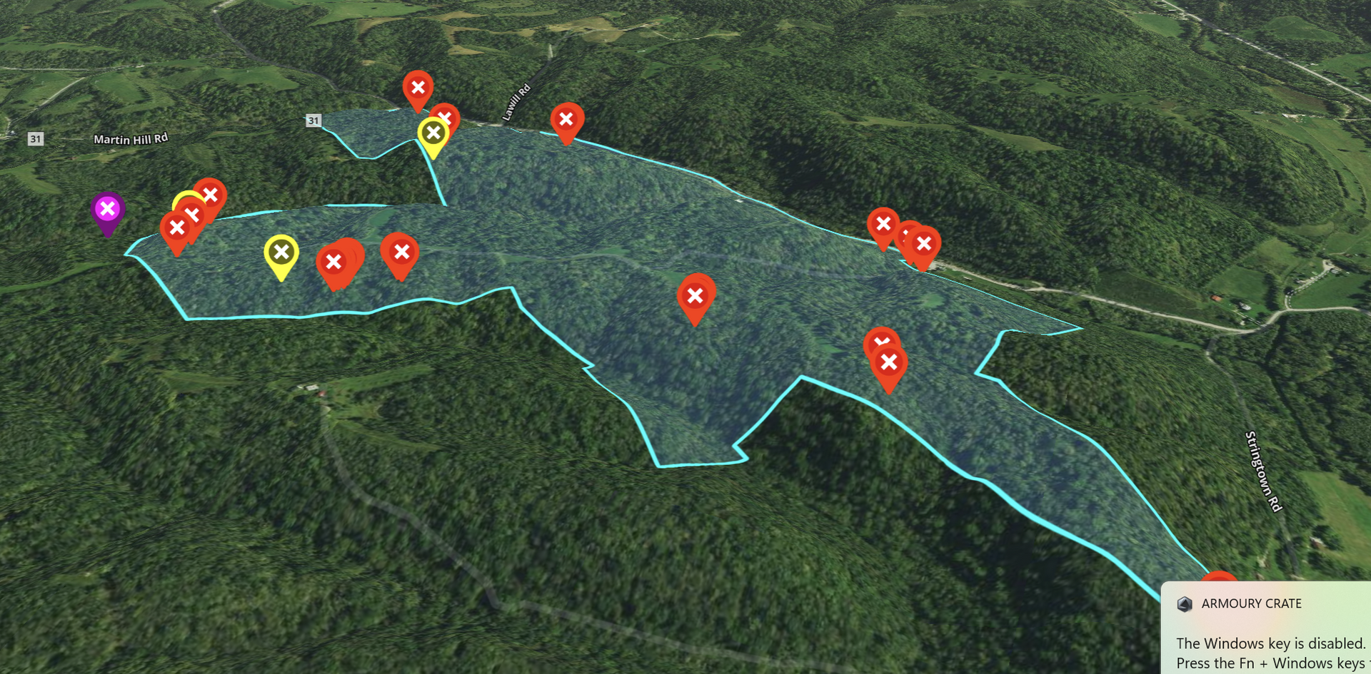
Our thermal drone deer surveys give you accurate, detailed data on the deer population and movement patterns across your property. We count does, bucks, and fawns, identify bedding areas, and map travel routes so you know exactly how your herd is using the land. Every survey comes with a comprehensive written report and a custom map uploaded to your OnX account, making it easy to plan hunts, manage your herd, and optimize your land for success.
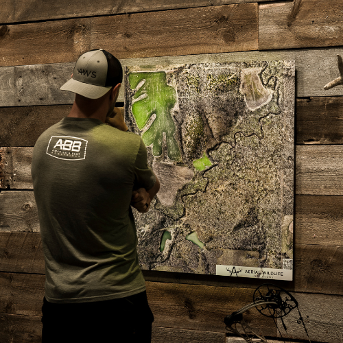
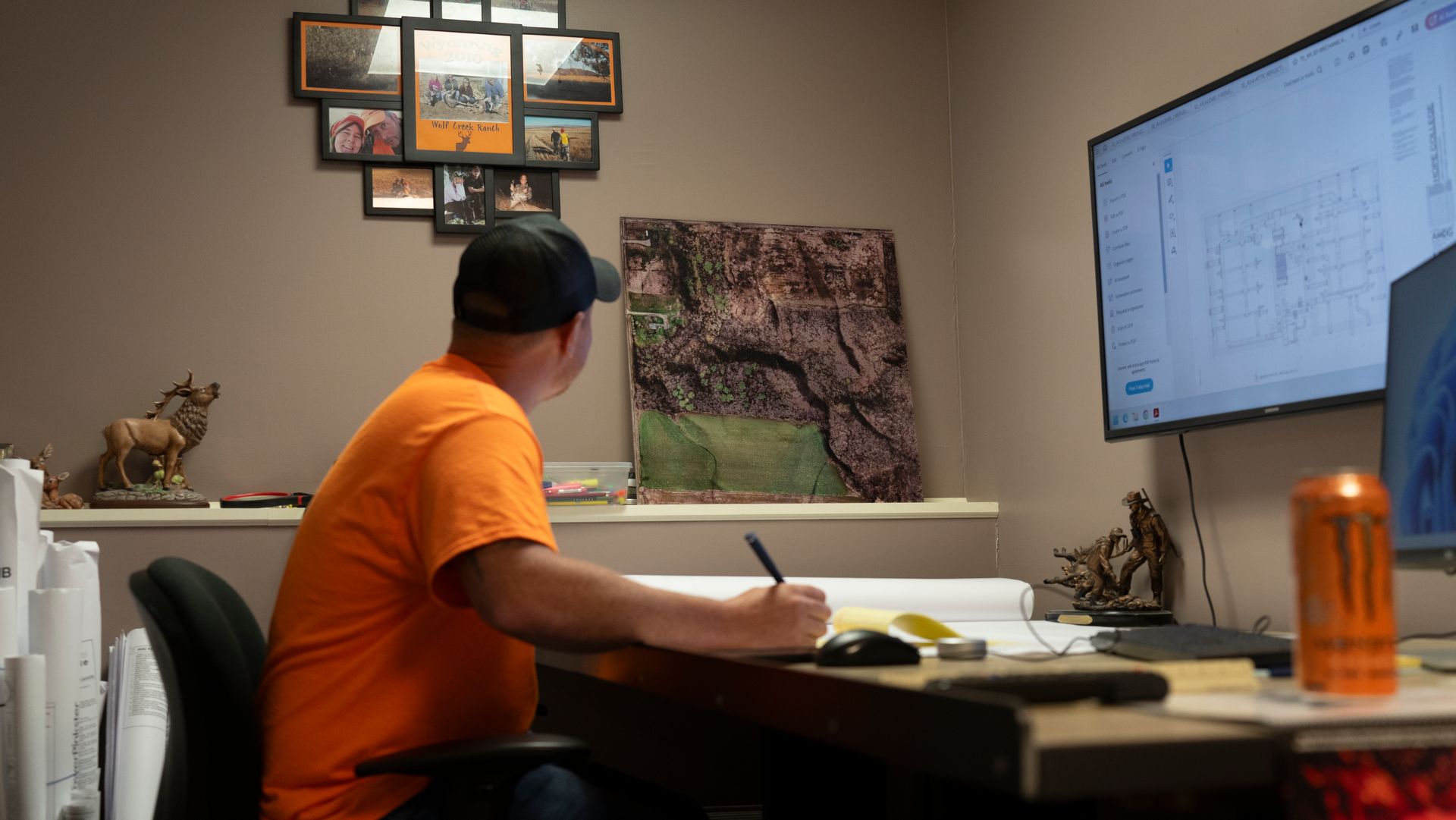
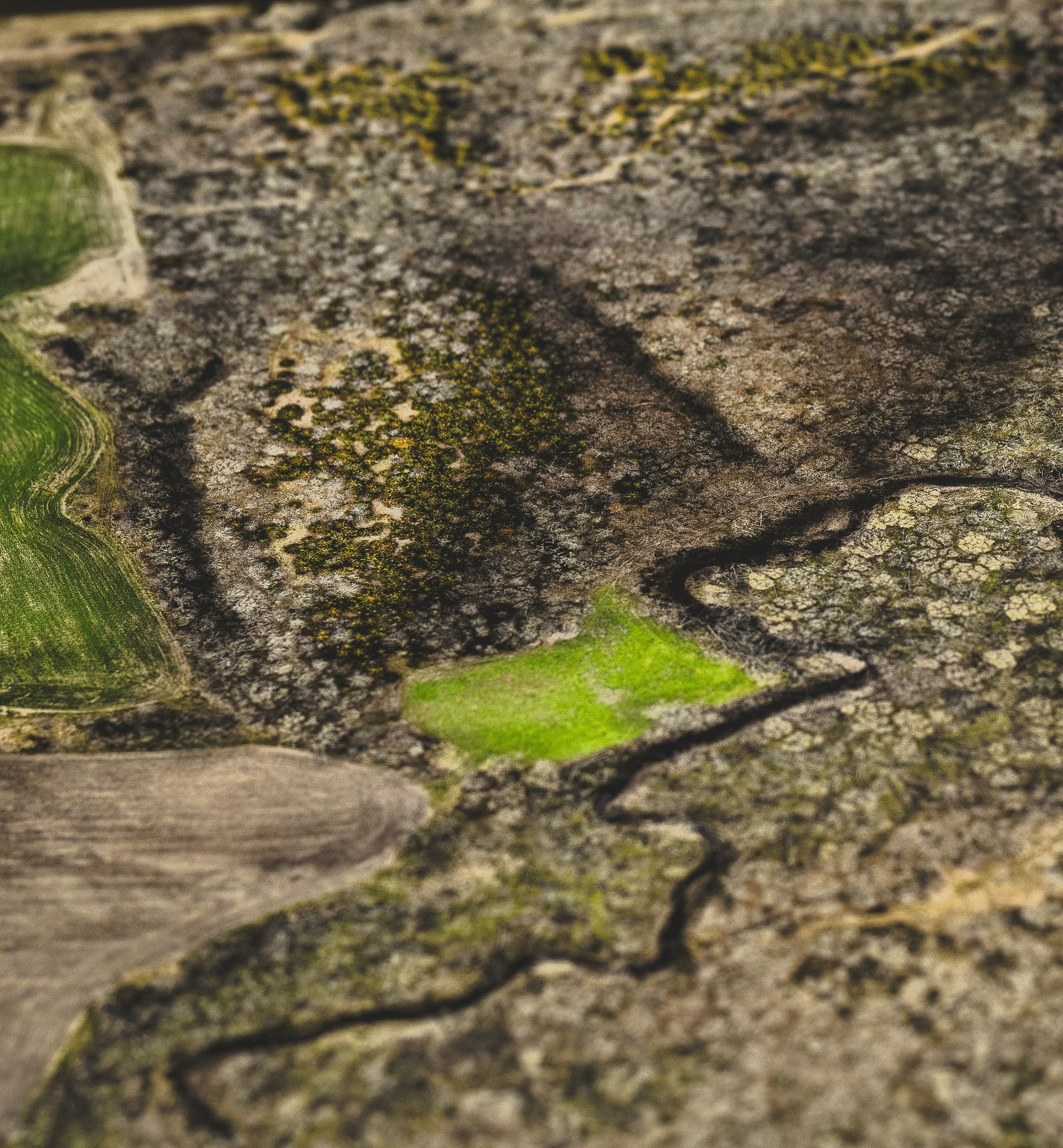
Custom Property Mapping See Your Land Like Never Before
Our custom aerial property maps give hunters and landowners a clear, detailed view of their land from above. Using high-resolution drone imagery, we create maps that highlight field edges, timber lines, food plots, water sources, trails, and more — perfect for planning hunts or managing your property year-round. Choose from durable laminated maps for the field or premium aluminum wall maps for your hunting cabin or clubhouse. Every map is tailored to your property and can be overlaid with stand locations, trails
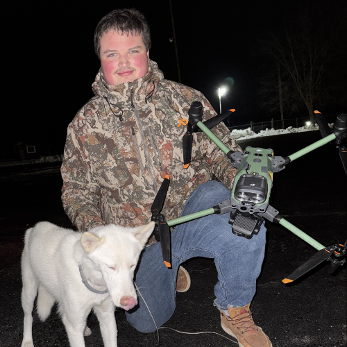
Locate Lost Pets and Livestock with Thermal Drones
Our thermal drone recovery services make it possible to locate lost pets and livestock quickly and efficiently. Whether it’s a dog lost in dense woods or livestock scattered across large pastures, our drones use advanced thermal imaging to detect heat signatures and pinpoint their location. This technology allows us to cover more ground in less time, even in challenging terrain or low-light conditions. Trust our team to help bring your animals home safely with fast, professional drone recovery.
How Deer Recovery Works
Step 1: Reach Out to Us
Whether it’s a call, text, or through our website, we’re ready 24/7 during deer season. Share your details, and we’ll ask a few quick questions about your shot and the property.
Step 2: We Make a Plan
We’ll assess the situation and create a recovery plan tailored to your property and conditions. Our team prepares the thermal drone and gear to give your deer the best chance of being found.
Step 3: We Deploy the Drone
We arrive at your location, set up, and launch our state-of-the-art thermal drone to scan the area. You can even watch the live search unfold on our viewing monitor, giving you a front-row seat as we work to locate your deer quickly and efficiently.
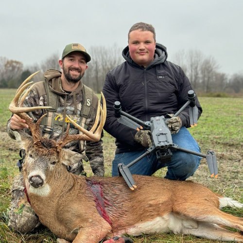
🦌 When We Find Your Deer
Once we locate your deer, we’ll provide you with exact GPS coordinates and set you up with directions on Google Maps or OnX Hunt. This ensures you can make a clean, direct approach to recover your trophy without unnecessary disturbance to the area.
Why Choose Elite Deer Recovery and Pet rescue?
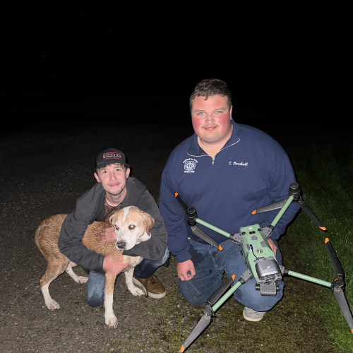
At Elite Deer Recovery, we’re die-hard hunters who understand how much every harvest means. Zander Parshall, our lead pilot, is passionate about pursuing mature deer and brings that same dedication to every recovery mission. As a full-time drone pilot, firefighter, and certified thermographer, Zander has the skills and experience to deliver fast, reliable results. We have 225+ recoveries and two seasons of experience. When you choose us, you’re not just getting advanced drone technology, you’re getting a team that lives and breathes the hunt.
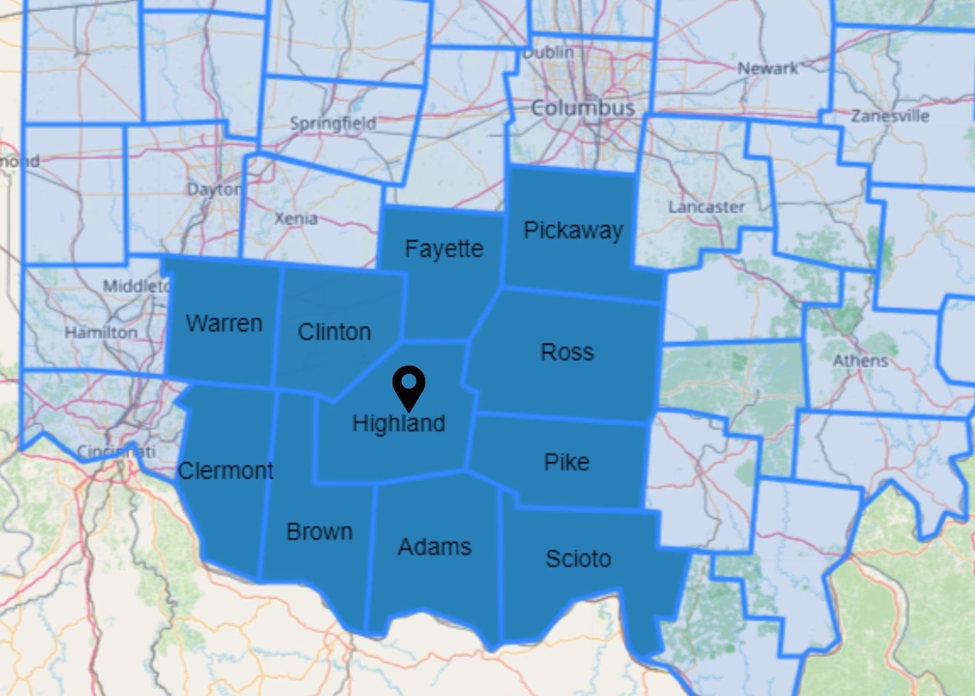
OUR SERVICE AREA
Elite Deer Recovery provides drone-assisted deer recovery across 10 counties in southern Ohio. Our primary service areas include Highland, Brown, Adams, Scioto, Pike, Ross, Fayette, Greene, Warren, and Clinton counties. Using advanced thermal drones, we help hunters quickly and ethically locate their harvested deer, even in challenging terrain or low-visibility conditions.
In addition to deer recovery, we offer professional herd analysis and high-resolution aerial property mapping throughout Ohio, Kentucky, Indiana, and beyond. Whether you're managing wildlife, evaluating habitat, or planning food plots, our drone services deliver the detailed data you need to make informed decisions across a wide range of properties and landscapes.
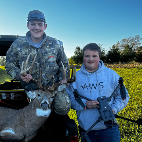
Check out our latest Recoveries